A Daybook in a Life–Days 168 &169

Civil War Battlefield Journey Continues….

Monticello, Photographed by Rufus W Holsinger via the Library of Congress.TMore


Sun.  June 17. 1984—Virginia–Had the best grits of my Southern trips.  We drove up to Monticello and did a fairly thorough tour.  The area surrounding reminded me, for some reason, of Olean though the vegetation was thicker, clustered certainly closer to the road and more “viney” than  W. New York. None-the-less,  that was an impression I got.  It was a beautiful day.  Hot, heavy sun.  I got a kick out of looking in the mirrors Jefferson looked in.  Mirrors have, after all, some spirit and image correlation.  It was interesting too, knowing Jefferson’s intense feelings about Monticello to try and imagine how peaceful and proprietary it would feel to have all that – the long terrace of gardens, the Mulberry Row of shops, the walks of flowers, the sense of satisfaction the Presidency would give.

I got a crush on a chubby little blonde girl who took tickets outside the east entrance and when she and her little skinny sister walked off down the path, something little placed in my heart sighed and will wonder forever.

We packed up and headed for Ashland, Monroe’s house, just two miles and visible from Monticello.  It had nothing of the “consequence” about it that Monticello does, but was interesting in a general way.  Peacocks (and pea hens) roamed the grounds.

Then on the road again North, via Rte. 64W and then to Staunton and Rte.11 North, the old Valley Pike.  I saw the wooden mill in Edenburg that Sheridan spared because it was the town’s only livelihood.  We stopped just short of Winchester and I took a long walk to determine the situation vis-a-vis the Battle of Kernstown.  I believe I have succeeded and will put my conclusions to test in the morning.

**Also on Rte. 64 we drove up the west side of the Blue Ridge Mountain in a gushing rain storm, and as we were just coming out of it, there galloping beside the road and alongside a “falling rock” fence was a baby fawn.  Disposition not known.

Sketch of the Battle of Kernstown, Sunday, March 23d 1862, Jedediah Hotchkiss. Via the Library of Congress Georgraphy and Maps Division.

Mon.  June 19, 1984—Virginia, Maryland and New York–Zach slept and slept while I read and wrote–a beautiful foggy morning in the Shenandoah Valley.  The very nice motherly Oriental woman who seems to own the place signaled me over for a cup of coffee and then couldn’t get the dispenser to work.  She thought Zach was my wife.  Two nights before a Pakistani motel keeper thought he was my father.

We drove a mile or so up Route 11 to the middle Road and then drove Southwest for app. 1 mile.  A ready row of trees went diagonally NW across the field.  I selected this as the sight of the stone wall of the Battle of Kernstown.  We drove the car up a farm path alongside the extended clump of trees and stopped where there was a break through.  Some older fella drove up in a station wagon. His son owned the property.  Later a real pretty lady came by named Kooce.  The owner was her husband.  She said that they were of the opinion that this was the place too and that reenactments had taken place here as well.

So we hit the road pretty well pleased and headed for Sharpsburg.  A few wrong turns later we were there, had lunch at the Red Byrd and headed out to hunt for property.  It had gotten very humid and hot.  I wasn’t feeling to extremely earnest about finding a place so after some desultory looking around, we headed back to NY.  Dropped Zach off and made it to the apartment by 8:15.  Took and abbreviated walk and made some phone calls:  Lee, Wade, Marta, Liza, Mom & Dad, read a bit and to bed.

Photos:

Holsinger, Rufus W., Copyright Claimant. Monticello Cirkut. Photograph. Retrieved from the Library of Congress, <www.loc.gov/item/2007663557/>.

Hotchkiss, Jedediah. Sketch of the Battle of Kernstown, Sunday, March 23d. 1861. Map. Retrieved from the Library of Congress, <www.loc.gov/item/2005625007/>.


A Daybook in the Life — Days 166 and 167

One of Many–A Journey to Civil War Battlefields

Seat of the War in America, Bacon & Co. — via Library of Congress, Geography and Map Division.

Fri. June 15, 1984—New York and headed south—In the car at 7a.m. Down Fifth Avenue to 34th Street without a stoplight.  One of those new morning—old routine days in Manhattan.  Zach and I underway for the south at 8:30 or so.  A nice, cool, sunny day.  Gettysburg at 12 noon.  Hiked the battlefield, bought some books, watched the electric map (in exactly the reverse order that I’ve described) and generally enjoyed the afternoon.  After going northwest of town to see Reynold’s statue, we headed down Rte. 15, having a bit to eat in Leesburg then stopping for the night in a genuine fleabag near Warrenton.

Sat. June 16, 1984—Virginia—A reasonable start in the rain for Richmond.  We found a nice diner in Culpeper.  I ordered “blueberry cakes” and got some pancakes, covered with a gruesome blue smelling paste.  I ate around it and did fine.  Couldn’t find Kelley’s Ford nor the road leading to Clark Mtn. but we made it to Richmond all right.  Some cute little blonde girl screamed “stupid” at me when I was looking at the map and trying to figure out where to go but otherwise, Richmond was a bit run down and quite placid.  The downtown looked like an extended Olean with a three and four-story building kind of fading in the sun, the signs turning the weary off-color of long exposure.

The Confederate Museum was great, full of artifacts and little bits of business that everybody had been using the moment they were shot.  The presentation was in a chronological sequence and finishing the exhibit you’d pretty well worked your way through the war,  There was a distinctly southern bias to the tone, most notable in the plaque describing the battle between the Monitor and the Virginia .

We drove around a bit.  The Confederate White House was lost, very much like Thomas Wolfe’s “Old Kentucky Home”, amid the glacial looking new buildings, including the Confederate Museum itself.

We went through some real “poor” white neighborhoods in our efforts to get to Hollywood Cemetery.  There was a beautiful, clear blue-eyed girl, tough as a savage, standing looking at us as we hunted up and down the run-down streets for the entrance to the cemetery.  The cemetery itself was impressive in a lush, Southern Victorian way.  It reminded me of a swimming pool emptied out with heavy rock walls and huge Eucalyptus trees towering over the mass of grave stones and mausoleums.  We saw JEB Stuart’s, John Pegram’s, John Tyler’s , James Monroe’s, Jeff Davis’s, Geo. Pickett’s, Fitzhugh Lee’s, and a few other graves—Southall Freeman’s.

Unable to contact Tommy K..  We left Richmond and headed for Charlottesville along Rte 250.  Long straight and rolling ride to the White House Motel.

Stay tuned–the trip continues……

A Daybook in the Life Days 160 & 161

Best Man on the Job

Fri., June 8—New York—I intended to spend the day gazing around but I ended up all morning on the telephone.  A hot, muggy day–sunny and steamy–but very nice.  I picked up J. at 3:10 pm and we drove in heavy slow traffic up 3rd Avenue, across 118th Street to First and out over the Willis Ave. Bridge and on to Greenwich.  I was told that a toast was in order for tonight and nearly collapsed but that turned out not to be true.  We went to the rehearsal and things went smoothly.  The rehearsal dinner was very nice and the toasts were very touching.  T. and I eventually G. went to Tumbledown Dicks and stayed until 2.  Mr. P. growled at us from the landing when we came in.  Top bunk J’s room.

Sat., Jun 9–Greenwich, CT—The wedding. Got up early enough and went out for a walk with T. and C.  I sat down in every available corner to work on my toast and try to come up with a whooping last line.  I sat out by the swimming pool in the steaming heat and, this time, finally boiling sun. We suited up and got to the church in plenty of time. There was a “hard feelings” other wedding in progress.  After it was over, the bride’s mother came charging up the aisle demanding to know where their flowers had gone.  We said , “The ushers took them,” and she said, “Whose ushers?” in a screech.

The ceremony began with only a slight delay at 2:05 and proceeded beautifully.  C. burst into tears at the end of her short walk up the aisle and things got underway.  The ceremony was short and sweet.

I drove with J. and C. R. to the reception. I was getting very nervous by this time but enjoyed myself nonetheless.  My toast, followed by a reading of a couple of telegrams and a short decent description of J. and of our life and times and the jumping on me story about Leslie.  My finale was:  May you always awake at the top of the morning, live in the best of days and sleep wherever the hell you like.

After J. and L. left, J, P. and I drove back to the P.’s house.  We took a swim, then went out to the Jardines and then I drove C. R. home to Khakum Wood and headed to NYC with a big cigar.

A DayBook in the Life — Day 156 through Day 158

Business and Bachelors

New York—Mon. June 4, 1984–Nice day.  Headed off early for Westchester, then over the Throgs Neck Bridge to Long Island.  Mom and Dad arrived at 7:00 p.m.  Preparations under way for J.’s bachelor party. Out to a small dinner and to bed at 12.

New York–Tuesday June 5, 1984–Set out with Dad for INA.  One of the first sunny, steamy days of the year.  Subway downtown, good meeting.  We had lunch in the INA cafeteria and headed home.  Mom had the apartment all cleaned-up.  Flowers in the windows, tables set up.  Very nice.  Dad and I bought two cases of beers for $50 which caused some soul-searching but I kept thinking: this is once in a lifetime stuff.  Everybody was up and down the stairs all afternoon.  Mrs. Graham’s refrigerator stayed in the hallway the entire time.

Liza came just after the parents took off — about 4:30.  J. arrived just as Liza was leaving, about 7:30.

The gang began arriving about 8:00.  Once the food came I started drinking beers and smoking Woody K.’s cigar and I had a very muddled and cheerful evening.

New York–Wed. Jun. 6, 1984–D-Day’s 40th Anniversary.   I woke up with a faint sense of unwell being—head aching and tired but generally okay.  Jeffersonville and Ellenville.  I cancelled my plans to go dancing with Cathy.   Marc C. arrived on my doorstep with a bottle of French white wine, ready for the bachelor party.  For some reason I’d half wondered if he’d show up a day late because I thought it was odd he hadn’t come or called.

Listened to a tape on the radio and sat in the living room with the table cleared and Franny and Zooey opened, looking for ideas for a toast.  Nothing conclusive yet.  D.B. called collect and we talked until 1.

A DayBook in a Life– Day 74, Day 133, and Day 140

Wedding Bells and Blues

New York—Wed. March 14, 1984—Stayed in town, mostly to meet J.P. at Brooks Bros. and pick up our wedding attire.  I guess L. knows what she’s doing after all since things look pretty nice.

I played my electric guitar for an hour or so and got down a rousing version of One After 909. 

The day’s most intese experience was a poor incredibly dirty heap of a man picking his toes on the subway while I was enroute to Brooklyn.

New York –Sat.  May 12, 1984—A strange, atmospheric day.  The sky was a half white blue the color of a baby’s cornea.  Clouds were sort of blooping out of it, forming a series of thick, doughy obscene shapes.  At the same time, looking west down the side streets, lights were gleaming sweetly against the clearing evening sky.

Early in the evening, it blackenend and yellowed and gave all indication of a violent storm, but only a brief, fairly heavy shower came of it.

I was downtown at Bloomingdales at the “Registry” buying wedding presents for K.H. and J.P. and L.  It’s on a computer and the “read-out” lists all the items desired and how many have already been bought.  And once you buy the items they are handled, wrapped and delivered without any further concern on the buyer’s part.

Zach came to town and we went to see Moscow on the Hudson.  T.B.’s movie.  It was good but not exactly great.  I also, with Zach’s expert assistance, bought a lottery ticket.  The prize which was being drawn was $22 million.  I did not win.

New York—Sat. May 19, 1984—K.H. got married today, with her hair cropped short and her little thin neck and her mother not bothering to come, she was such a pretty and individual looking bride that for the first time I felt a real twinge of regret that some girl was gone forever.

Met Jane and Steve at the wedding and went with them to the reception.  It was down in the lower east side across from the Strand.

I walked home and ate apples and cheese ravanously. Also, at the reception talked earnestly and nonsense with M.H. for about ten minutes and felt enormously relieved–don’t ask me why.

A Daybook in a Life – Day 105

Sat. Apr. 14,1984–New York—Looking out the window this morning at 10:00 a.m., it looked cold and deserted as a bad November day.  Discouraging weather.  One must, however, keep up one’s spirits.  What alternative, tell me, has one got.

L.W. called and wanted me to meet H. and J. for lunch. L. said he needed help.  So I trudged down to the Trump Tower in the rain and it turned out not to be a cozy lunch but distant relations. A., M. and Mother S, of whom, I’ve never even heard.  Anyway, we raced through lunch then they tore off to a play and that was that.  L. and H. and I ended up starring at one another as if we’d survived a hurricane on the roof of a house.

I trudged on home in the rain and spoke to L.P.   P.C. is house manager for a settlement house on W. 46th play center so Z. K.  and L.P. and I went down and met P. C. there.  The play was The Shoehorn by Mark Wiston, a pretty dreadful play about marital infidelity among the older generation.  Afterwards we went out and had dinner with the sound and lighting people–a nice girl name L.S. who lives in Brooklyn, a nice, nervous wreck of a kid with an earring–an uneasy addition to anybody’s wardrobe so far as I am concerned and another nice guy who reminded me of G.P. with overtones of C.B.

That was fun.  Home by 1:00 a.m. in a cab.  Englsh cabbie.

A Daybook in the Life–Day 93 and Day 97

Mon.  April 2, 1984—New York–I started off yesterday in pretty high spirits, striding to the bank, having my shoes shined, stepping fancifully around in the nice warm weather.  Things went pretty rapidly downhill though when I’d gotten home.  I was cleaning, folding and vacuuming for Dad’s arrival when I became inspired about taking C.B. out.  So I bought tickets over the phone to Sam Shepard’s True West and called the B.’s number.  T. (her sister) came on and immediately said that everybody had plans and suddenly I went from young man about town to kid in serious trouble.  The nadir was calling W. R., a tough but nice seemingly girl from Berryville, Virginia (scene of some interesting activity during the Civil War), and having her roommate answer and hear W. saying in the background to tell me she was talking a shower.  I had to hang my head at that one.

Earlier though, on the bright side, I signed and mailed my tax returns, completed, including my eye test, and mailed my license renewal and a contribution to William Westmoreland for his libel suit against CBS.

During the day, I got a flat tire (a big nail punctured the tire but it didn’t go down, it just would have) right near where L.B. lives, so I went and left her a note.  In general a hurried retreat turning into a rout on the girl front.

Fri. Apr. 6 1984—New York–A pleasant enough day weather wise.  Did business on L.I.  Had a nice lunch with E. R., P. B, and L. D.  I think half of the girls in that office love L., odd because he is a huge man and looks like a walrus.

I went to see True West tonight—all by myself.  It was kind of nice because in that stunned and appreciative moment when the play ends, you don’t have to start chattering to somebody about it.  I think I called twelve girls to go to it and not a one would come—nobody—nada.  I got to the theater early though and sat in relative comfort eating a bagel out of my front pocket and reading a New Yorker article about Mario Cuomo.

I bought a great pirate Beatle record tonight—File Under Beatles.


A Daybook in a Life

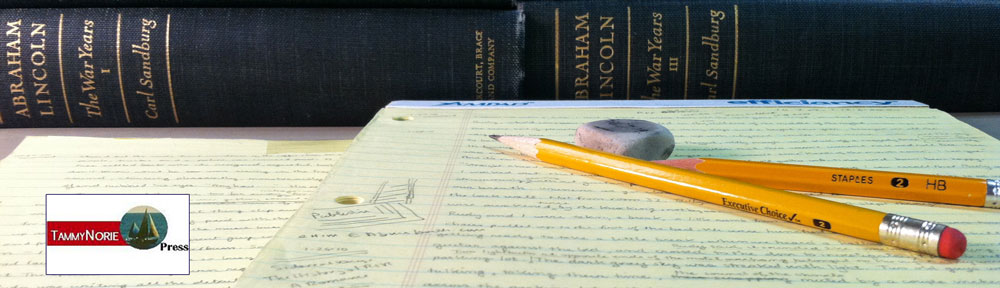
In 1984 I started what ultimately became I guess part of my life’s work—unbeknownst to me.  I bought a notebook at a stationary shop on the west side of upper Madison Avenue, probably in the upper 80’s, about three blocks away from my apartment in NYC.  It wasn’t special.  It was just a notebook and on December 31, 1983 I started writing in it–daily.  Again nothing special, just where I went, what I did, the weather, what I ate, what I heard, what I saw.  There was never anything, “dark night of the soul” about the contents.  It was a daily account of my daily days, good, bad, fun, boring, dull, dramatic, but not merely jotted down, rather a fairly full and carefully composed (for the most part) out line of my day with random thoughts and observations.

During those 34 years, I dated, I got married, I had three children, I met scammers and con men, faced financial ruin, rid a house of bats, stymied conmen and scammers, started a business or two, made maps, wrote books, gave numerous presentations on Civil War Maps and Mapmaking culminating in a nationally broadcast presentation on C-Span BookTV.  I used my wits, held a couple of political offices, wrote a few songs, served on some interesting boards, read a lot of books, wrote and published a few articles,  played guitar on the street, broke my leg—a compound fracture—and my wrist in Carcassonne, and stayed in touch with friends some of whom I had since childhood.

This year I got the flu right after the New Year and in my flu stupor I pronounced to my family that I was quitting, what I call, my daybook.

They would not allow it – “Dad,” they said, in unison.  “Your day book is not for you anymore—it’s for us.  You cannot stop.”

I agreed.

I thought about it….how many people can account on a day to day basis for everything they’ve done for 34 years, 1 month ….and counting?  That’s 300,000 hours, 12,500 days and 1,786 weeks.

So over the course of the next few weeks, months, whatever, I plan to post some of my daybook entries.  I will just use initials for most of the people I came in contact with – except maybe the con men, they might not remain nameless—we’ll see.

And stay tuned.

Yes! There is a Method to our Mapness

As a historical cartographer–one who doesn’t use a computer to draw or to do research, I could be considered a dinosaur, maybe a buggy whip. But details in mapping are important, especially when recreating a historic place–a place that existed when the population of the United States was 55 million, before the industrial revolution, before oil was discovered and  long before automobiles were the prefered mode of transportation.

So how are our maps completed?

I use contemporaneous photographs, taken within days of some of the major battles for Gettysburg and Antietam.  I asked an agronomist, a crop expert, from Cornell  to study the panoramic photos of these fields to determine the crops in the fields. It was easy to figure out what type of fencing there was, where the orchards were, the extent of the woodlands etc. Essential to the use of these photographs was the 1970’s work of William Frassanito, who painstakingly determined the point-of-view and location of each extant wartime photograph of Gettysburg and Antietam.

Then I used regimental histories–each regiment would occupy a small sector of the battlefield and their accounts and maps  would show their particular sector in great detail. The soldiers’ diaries and letters (this was probably the most literate war in history) also contain many references to their immediate surroundings. Many of them were themselves farmers and they would frequently comment on the crops and fields, fences, barns and orchards. The most poignant research items were “burial” maps. Dead men were often buried right where they had fallen by their fellow soldiers, who were usually their townsmen, friends, even relatives. They would then send the family a very detailed map so they could journey to the battlefield, locate the body and bring it home for burial.

On the major battlefields such as Gettysburg, Antietam, Stones River in Tennessee, the National Park Service has tons of data that they gladly make available to a researcher.

Aerial photographs are very revealing if you know what you’re looking for. If I have a reasonably good Civil War era map and it shows a road or a lane that’s vanished, or a barn or a house, if you look very carefully, you can find a footprint or a trace of it. Also, the skeleton features in the landscape – the rivers, streams, hills, principal roads etc. – are obviously extant features on todays extremely accurate USGS maps. So those features are immediately drawn on my map,  providing an immediate reliable framework.

The maps drawn and used by the actual Civil War armies, while not terribly accurate in terms of exact distances and such, are full of the sort of information the armies needed. They wanted the name of residents along the roads because there were no route markers and there were not normally formal names for a given road or lane. The surest way to get reliable directions was to get pointed toward the Smith’s house or the Jones farm. Documenting the residents also gave the armies an idea of the local population. The more residents there were, the more resources there were for the armies to live off. (Union General William Tecumseh Sherman set off across Georgia on November 16,1864 saying, “Where a million Georgians can live, my army will not starve.)

The armies also had to know where they could find corn fields, wheat fields, orchards, hay fields, wells, springs etc. because an army on the march needed to feed 30, 40, 50 thousand men  and thousands of horses and mules. A typical mule would drink 10 gallons of water a day. Multiply that by 10,000! A Civil War army (and it didn’t matter whether they were friends or enemies, Union or Confederate) would devastate any countryside they marched through. They would take all the food for themselves and all the forage for their animals, drink the wells dry, destroy the fields they camped on, empty the barns, clear out the larders, tear down all the fences (to make their camp fires to brew their coffee) and raise havoc generally. But the armies need to live off the land is great for mapmakers because their military “route” maps detailed this sort of food and forage information so the armies knew where they could march and fend for themselves.

A great aid in mapping Gettysburg was the work of John Bachelder, who arrived in Gettysburg immediately after the battle. Bachelder marched up and down the field, mapping it, and he had as a resource the thousands of wounded soldiers, Union and Confederate, remaining behind, who he interviewed. His map, a birds-eye view of the field, was very reliable and valuable.

There were also quite accurate published county maps available of some areas, including Gettysburg, published prior to the Civil War that I used. (They were also used of by the armies and the generals.) Also, soon after the war, the U.S. War Department prepared surveys of many of the major battlefields. These maps were much more detailed and accurate than the maps made under wartime conditions. (The U.S. hired former Confederate mapmakers to work on these surveys. One Rebel named Blackford, who’d sworn he would die rather than live again under the stars and stripes, found himself, within a month of Appomattox happy to be working for the U.S. Army mapping the battlefield

Finally, almost every Civil War battlefield has people who have devoted their lives to studying “their” battle. They know every nook and cranny of the field and like nothing more than to guide someone around the field, point out sites, recommend books and resources, provide access to private lands and to other knowledgeable locals, and in some cases they fix parking tickets incurred locally.

There are other resources but the above provides a pretty good idea of what’s out there. I decide on the reliability of the information based on the resource I used. Photographs, for example, are irrefutable–at least back then they were, before Photoshop.  Other data would often be corroborated by some other data. And then you have to wonder why anybody would mislead about the existence of a stone wall or the presence in their front of a rye as opposed to a wheat field.

After I have everything in place.  I get to add trees and terrain.  I get to print.  I guess I was given the talent of being able to print–very legibly and very small. And finally I get to watercolor.

All my maps are done on a desk that  I found in a barn–it was probably the carriage house for the only New York State governor that hailed from my city.  Unfortunately it wasn’t his desk. I needed some thing flat and this table was tucked away, dusty, covered with some weird tack paper–nobody had used it in years.  I cleaned it up and gave it a second life.  It looked so nice that my landlady wanted it back when we moved.  I offered her $25 for it–I had already completed Pea Ridge and Shiloh and was in the middle of Antietam,  I was rolling.    I can’t remember if she took the money or just let me have it. I am thinking she took it.

  • Top Image: The Wheatfield at Gettysburg Battlefield — Courtesy: Library of Congress

  • Middle Image:  Jedadiah Hotchkiss Gettysburg Map Detail.  Photograph of the original in the Handley Regional Library, Winchester, VA  by Rodney Lee Gibbons, CPP. The map appears in Maps and Mapmakers of the Civil War (Abrams 1999) by Earl B. McELfresh

  • Bottom Images:  McElfresh Map Company’s Gettysburg products.


Presentation at the Eldred World War II Museum


PT Boat 490 Photo Courtesy: McElfresh Map Company LLC

PT Boat 490
Photo Courtesy: McElfresh Map Company LLC

The naval battle of Leyte Gulf was fought on October 25, 1944 in the waters off the coast of the Philippines.  It was not only the greatest naval battle of the Second World War, it was also the largest naval engagement ever fought on the high seas.

In a presentation this coming Saturday at 2:00 PM, October 25, the Seventieth Anniversary of the battle, at the Eldred, Pennsylvania World War II Museum, Earl McElfresh will describe the events leading up to this battle and the part his father, Lt. John M. McElfresh, as skipper of P.T. 490, played in this enormous sea fight that effectively knocked the Japanese navy out of the war.

Lt. McElfresh is mentioned prominently in every account of this battle, which involved 200,000 men and 244 ships, including the two largest and most powerful battleships every launched, Japan’s Yamoto and Musashi.

Crew of PT 490  Photograph Courtesy; McElfresh Map Co. LLC

Crew of PT 490
Photograph Courtesy; McElfresh Map Co. LLC

In a talk entitled, “My Dad vs. the Empire of Japan,” McElfresh will detail the actions of his father as he earned the first of two silver stars awarded to him by the President of the United States: “For conspicuous gallantry as officer in tactical command of P.T.’s 490, 491 and 493 in action against enemy Japanese forces during the battle for Leyte Gulf on October 25, 1944.”

Earl McElfresh of Olean is a Cattaraugus County Legislator and owner of McElfresh Map Company.  The World War II Museum is located at 201 Main Street in Eldred.