Question 9: How did the draft work during the Civil War?
The draft was a pretty shabby affair for both sides and it was also manifestly unfair. In the North a drafted man could buy out for $300. That was a lot of money then and only the wealthy could afford that. They would then get a substitute. They were often enough shady characters who would take money, enlist, desert at the first opportunity and enlist again, again for money, using an alias – and on and on. In the South, there were numerous exceptions and the saying was, “It’s a rich man’s war and a poor man’s fight.” In other words, the wealthy men who owned the slaves (and they made up a tiny fraction of the overall population) that the war was really all about were not drafted because they had to stay home and oversee the slaves etc. Initially, in the South, draft age (and there were many occupations, including service in the non-fighting state militias e.g. that were exempt from the draft) was from 18 to 45. By the end of the war, they were taking men from “cradle to grave” 16-65. The draft, for both sides, was pretty much a disaster.
Question 10 Did we have the Medal of Honor during the Civil War?
There was a Medal of Honor during the Civil War. It was awarded much more liberally than the present day Medal of Honor and it was sometimes given to an entire unit for some especially meritorious action. There were several local Medal of Honor winners including a Mr. Oviatt (the street next to Boardmanville school is named for him) and Stephen Welch. Mr. Welch, your OHS teacher, is a direct descendent. Stephen Welch is buried in Allegany cemetery. Mr. Welch can tell you all about him.
Question 11 What was the most important information a battle map could provide for the armies? Elevated ground?
The most important information a map could provide a Civil War commander was enough knowledge of the ground that he knew where he could march and maneuver his army (where he could pass through a mountain range, where he could ford a river, where he could feed his men and water his animals, what multiple roads he could spread his army out on and still maintain contact between the separated units and get them to the right place at the same time.) A commander mostly wanted to know from a map where he could go and what he could do and equally important to him, where his enemy could go and what the enemy’s options were. It was while the armies were angling for a battle that maps were most important. Once contact was made and battle was joined, they could scout around for information and to a limited extent see what was going on.
Question 6: How many people survived the prison camp at Andersonville, Georgia?
There were about 45,000 Union prisoners at Andersonville. Something like 13,000 of them died there, so there was about a 27% casualty rate. The biggest Union POW camp was in Elmira, NY. There was less excuse for the approximate 25% casualty rate for Confederate prisoners there since the Union, in contrast to the South, was thriving throughout the war. But those were very hard times and very hard people.
Question 7: Would you consider Robert E. Lee a traitor?
Robert E. Lee was still in the U.S. Army in early 1861 and he received a promotion. When you receive a new rank, you take a new oath of allegiance. You swear to defend the United States of America against any enemy, foreign or domestic. Within weeks of taking that oath, Robert E. Lee was a domestic enemy of the nation he had just sworn an oath to defend. That pretty much makes him a traitor I’m afraid.
I think the Southern aristocracy—which Lee was part of—had such a high opinion of their personal “honor” that whatever they did had to be honorable because it was their honorable selves doing it. I also think that their absolute power over their black slaves, and the iron handed rule they had over their plantations and their society gave them a bad case of arrested development. Their actions and opinions were so unchallenged that they had been gradually lulled into simple-mindedness.
Question 8: What was your favorite map to make? Why?
I really can’t say which was my favorite map to make. Each mapping project is really exciting, first because it’s a new job and it means money and it means you’re going to be profitably and happily employed for months and that’s nice. And it’s also wonderful to have a new subject to delve into, to dig around for resources and information. So I like that. It’s also a lot of fun to do the drawing and I really enjoy, for example, doing the lettering of the map titles. I usually meet some interesting people and get to travel to interesting places when I do the research…And as I got better at doing the maps, the ones done with more expertise were more enjoyable than ones done early on that I look back on and wish I’d done a better job. Long and short, I guess I’d have to say my favorite map is the one I’m working on or the next one I’m about to do. I guess my Pearl Harbor map is right up there though.
How long does it typically take you to create a map of a famous battle?
It typically takes six to eight months to do the research, draft the map, and then ink in the data and watercolor the whole concern. In the midst of that process, I also work out the information and secure the images for the reverse side of the map. That six or eight months means seven days a week, morning, noon and night. The maps are great fun but they’re also a lot of work.
What interests you most about the Civil War?
The most interesting thing about the Civil War is the participants. The panoply of characters, Abraham Lincoln, U.S. Grant, William Tecumseh Sherman, Stonewall Jackson, JEB Stuart, and more obscure characters like Richard Ewell (he married a widow and always introduced his wife as “Mrs. Brown”), Confederate general Joe Johnston who hated president Jeff Davis so much that you wouldn’t know from his memoir that he was fighting the Yankees, he’s always fighting Davis. Then George B. McClellan, Union general whose reputation collapsed because the stupid, vainglorious letters he wrote to his wife revealed him to be a supercilious jerk. There was General George Custer (of Little Big Horn fame) who was a brilliant cavalry leader who perfumed his flowing locks and designed a uniform that made him look like a circus performer. It was a wild bunch of characters. England had Dickens’ characters. We had these guys. Some of the most noble people in history, and some of the most ignoble, made up the cast of our Civil War.
Also, most wars are futile. For example, the First World War led directly to the Second World War and the Second World War wasn’t even over when the Cold War got underway. In contrast, the Civil War was fought to end slavery and preserve the United States. When the Civil War was over, slavery was dead and the United States lived. Success!
Who do you think was the greatest Confederate General?
I think Stonewall Jackson was the South’s great general but he had the advantage in that regard of dying too early in the war to confront the best Union generals. But I also think there was something vaguely—for want of a better term—autistic, about him. He seems kind of blank in terms of personality and he was a bewildering figure to his fellow generals. And his successes came in the first half of the war when the south fought with the immense advantage of a friendly population and in familiar countryside. His Valley Campaign, upon which his fame primarily rests, would not have been possible once Union forces knew the roads and topography as well as he did. But circumstances are what they are and he was, in my mind, the best in the 1861-1863 timeframe.
What is the oldest battle that you mapped?
The oldest battle I’ve mapped is the Revolutionary battlefield of Saratoga in NYS. It was fought in 1777. The oldest Civil War battlefield I’ve mapped is Manassas or Bull Run, VA. Two battles were fought there, 1861 and 1862.
Time did not allow me to answer all of the questions of the American History Class at Olean High School, but I did respond to them by e-mail. The first and second question were:
What information do you use to draw the maps? Do you use photos along with studying the landscape? What else do you use? How do you decide if the information is reliable or legitmate?
I had to give a rather long answer to the question:
I use contemporaneous photographs, taken within days of some of the major battles (Antietam, Gettysburg e.g.). I got a Cornell agronomist (a crop expert) to study the panoramic photos of these fields to determine the crops in the fields. It was easy to figure out what type of fencing there was, where the orchards were, the extent of the woodlands etc. Essential to the use of these photographs was the 1970’s work of William Frassanito, who painstakingly determined the point-of-view and location of each extant wartime photograph of Gettysburg and Antietam.
Then I used regimental histories – each regiment would occupy a small sector of the battlefield and their accounts and maps would show their particular sector in great detail. The soldiers’ diaries and letters (this was probably the most literate war in history) also contain many references to their immediate surroundings. Many of them were themselves farmers and they would frequently comment on the crops and fields, fences, barns and orchards. The most poignant research items were “burial” maps. Dead men were often buried right where they had fallen by their fellow soldiers, who were usually their townsmen, friends, even relatives. They would then send the family a very detailed map so they could journey to the battlefield, locate the body and bring it home for burial.
On the major battlefields such as Gettysburg, Antietam, Stones River in Tennessee, the National Park Service has tons of data that they gladly make available to a researcher.
As I mentioned in the class, aerial photographs are very revealing if you know what you’re looking for. If I have a reasonably good Civil War era map and it shows a road or a lane that’s vanished, or a barn or a house, if you look very carefully, you can find a footprint or a trace of it. Also, the skeleton features in the landscape – the rivers, streams, hills, principal roads etc. – are obviously extant features on todays extremely accurate USGS maps. So those features are immediately drawn on my map so I immediately have a framework to go by. And the maps drawn and used by the actual Civil War armies, while not terribly accurate in terms of exact distances etc., are full of the sort of information the armies needed. They needed the name of residents along the roads because there were no route markers and there were not normally formal names for a given road or lane so the surest way to get reliable directions was to get pointed toward the Smith’s house or the Jones farm. Documenting the residents also gave the armies a idea of the local population. The more residents there were, the more resources there were for the armies to live off. (Union General Sherman set off across Georgia on November 16,1864 saying, “Where a million Georgians can live, my army will not starve.) The armies also had to know where they could find corn fields, wheat fields, orchards, hay fields, wells, springs etc. because an army on the march needed to feed 30, 40, 50 thousand men and thousands of horses and mules. A typical mule would drink 10 gallons of water a day. Multiply that by 10,000! A Civil War army (and it didn’t matter whether they were friends or enemies, Union or Confederate) would devastate any countryside they marched through. They would take all the food for themselves and all the forage for their animals, drink the wells dry, destroy the fields they camped on, empty the barns, clear out the larders, tear down all the fences (to make their camp fires to brew their coffee) and raise havoc generally. But the armies need to live off the land is great for mapmakers because their military “route” maps detailed this sort of food and forage information so the armies knew where they could march and fend for themselves.
A great aid in mapping Gettysburg was the work of John Bachelder, who arrived in Gettysburg immediately after the battle. Bachelder marched up and down the field, mapping it, and he had as a resource the thousands of wounded soldiers, Union and Confederate, remaining behind, who he interviewed. His map, a birds-eye view of the field, was very reliable and valuable.
There were also quite accurate published county maps available of some areas, including Gettysburg, published prior to the Civil War that I could make use of. (They were also made use of by the armies and the generals.) Also, soon after the war, the U.S. War Department prepared surveys of many of the major battlefields. These maps were much more detailed and accurate than the maps made under wartime conditions. (The U.S. hired former Confederate mapmakers to work on these surveys. One Rebel named Blackford, who’d sworn he would die rather than live again under the stars and stripes, found himself, within a month of Appomattox, working for the U.S. Army mapping the battlefields.)
Finally, most every Civil War battlefield has people who have devoted their lives to studying “their” battle. They know every nook and cranny of the field and like nothing more than to guide someone around the field, point out sites, recommend books and resources, provide access private lands and to other knowledgeable locals, and in some cases they fix parking tickets.
There are other resources but the above provides a pretty good idea of what’s out there. I decide on the reliability of the information based on the resource I used. Photographs, for example, are irrefutable – at least back then they were, before photoshop – and other data would often be corroborated by some other data. And then you have to wonder why anybody would mislead about the existence of a stone wall or the presence in their front of a rye as opposed to a wheat field.
McElfresh Map Company will be watching a new movie coming to town with more than a little interest.
We received a phone call at our office on the afternoon of August 26, 2011 from Terry Alford, a professor at Northern Virginia Community College. He wondered if we’d be willing to share some information about Civil War map making with some folks making a Lincoln related Civil War movie. I said certainly.
Very shortly thereafter I got a telephone call from a woman named Leslie McDonald. She was with a company called “Office Seekers.” She was interested in having someone with a Civil War map background to answer some questions. She was with a movie company. I said I’d be quite prepared for that eventuality.
We talked back and forth a bit, I answered some general questions. She said she would like to e-mail a detailed set of questions if that was all right. I said that would be fine. She also asked if I’d be willing to suggest additional questions that “they hadn’t asked but should.” That impressed me. She wanted to get things right. “So,” I said, “This is a real movie, a TV movie, or what?”
She told me it’s a movie based on Doris Kearns Goodwin’s book Team of Rivals. The director of the movie was Steven Spielberg. I said, “Ah, this is a real movie.” She laughed. “Oh yes.”
She had some general questions regarding reference material, Civil War map resources, sample Civil War era maps and the preparation and use of maps before, during and after a battle.
That evening (6.06 PM) a list of 12 questions was e-mailed to me. The questions were mostly map specific:
How would they update troop movements and how would they do this for the President?
How did they track movements on maps?
What type of writing instruments did they use to update maps, i.e. pen, pencils, colored pencils?
How would maps in the White House differ from the field maps?
Some of the initial questions also regarded the treatment and handling of battle casualties and soldiers killed in battle:
Did they write down who died right away or after the war was over?
As per Leslie McDonald’s request, the next day I e-mailed her a brief overall perspective of the who, what, when, where, why and howof Civil War mapping. How important maps were, especially to Union forces operating on unfamiliar ground in unfriendly territory. I told her where to find examples of Civil War maps and descriptions of how they were prepared and used and to what effect.
I also emphasized what an immense affair the Civil War really was and how magnificently a ramshackle government inWashingtonmanaged the whole affair. The various departments were casually organized, the army and navy operated in a very off-the-cuff manner compared to the hidebound rigidity of the modern military. The President throughout the war never travelled more than 100 miles from Washington, wrote his own speeches, and ran the nation and the war with the assistance of two secretaries.
To provide perspective, I noted that the death rate of soldiers in the Civil War, if adjusted to the present population of theU.S.would be 3,000 soldiers killed and dying every day for four years.
I also described the topographical challenges faced by road bound, foot and horse-powered armies. How a slight grade or a three foot deep creek could stop 50,000 men dead in their tracks. How the marching armies lived off the land and had to keep moving or starve.
I also assessed the capabilities of the Union and Confederate armies and pointed out that Union forces faced a far greater challenge than the Confederates because they had to march, fight, capture, hold, occupy, supply, and continually advance through the southland. The Confederates didn’t have to fight pitched battles around Detroit, or Chicago or New York. The Union had to capture and hold New Orleans, Memphis, Nashville, Savannah, Vicksburg et al.
Over the next days and weeks I answered questions:
How would maps be carried in the field?
Answer: Sherman, e.g. carried them in his saddlebags. Others in map canisters. Cavalrymen stuck the maps in their pockets.
What sort of maps did the President have in the White House?
Answer: Most likely Lincoln’s office contained U.S. Coast Survey maps (this organization is the predecessor of the modern National Oceanographic and Atmospheric Administration (NOAA) and standard commercially printed maps (Colton’s e.g.) The maps specifically, historically, known to have hung in Lincoln’s office were a U.S. Coast Survey map of KY and TN and a “statistical” slave map, showing by lighter and darker shading the slave population of the different regions of the country.
What sort of maps were in the War Department’s telegraph office?
Answer: What’s described as “a common U.S. map” on the wall (meaning a commercially printed U.S. map) and then there were map files, filing cabinet-like wide drawers in which maps could be laid flat and stored.
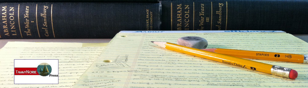
I also described the various instruments the mapmakers would be using: the Schmalcalder compasses, plane tables, field glasses, the watercolor paints that would come in blocks rather than tubes. I further informed the moviemakers that there was no way for Lincoln or Secy of War Stanton to interfere in the actual progress of a battle. I told them Lincoln or Stanton might urge the generals to “put all of your men in” but they’d have no way of knowing what was happening on the actual battlefield.
My last e-mails in early October with the “Office Seekers” crew was to supply names and contact information for locating the appropriate topographical instruments to “decorate” the movie set.
Note the a map displayed in Lincoln’s office in the trailer below.