I prepared a reading list of Civil War volumes to hand out to an Olean High School junior year American history class as part of a Civil War presentation on Jan. 15, 2013. The list is short and sweet and my basic premise was that, for the most part, none of the students had read much, if anything, about the Civil War. My intention was to suggest some books that would be scholarly but entertaining and informative at the same time. Also the list had to fit on one page. This is the list I came up with. My feeling is that if any of the students read even one of these volumes they will probably be drawn to read others as well.
Bruce Catton’s trilogy on the Civil War, which includes The Coming Fury, Terrible Swift Sword, and Never Call Retreat, is a very dramatic and beautifully written set. It’s accurate history but it reads with the verve of a novel. A pretty long novel though.
Bruce Catton also wrote a terrific little book entitled U. S. Grant and the American Military Tradition. It’s one of my absolute favorite Civil War books. And it’s short!
There are two excellent one volume biographies of Abraham Lincoln. Stephen B. Oates’s With Malice Toward None and/or Benjamin P. Thomas’s Abraham Lincoln. Another really neat little book is this same Benjamin P. Thomas’s Lincoln’s New Salem.
The best single volume account of the overall Civil War—it’s pretty long and quite detailed but extremely worthwhile—is James M. McPherson’s Battle Cry of Freedom.
There are all sorts of truly fascinating first person accounts of being a soldier in the Civil War. These books are America’s Victorian literature. We don’t have a Dickens, a Trollope, a Thackery, an Eliott…but we do have these. And they’re not only thrilling and entertaining but they’re also true. There are dozens of these but two of the best are: War Years with JEB Stuart by W.W. Blackford and I Rode With Stonewall by Henry Kyd Douglas.
The Blue and the Gray, edited by Henry Steele Commager, is a chronologically arranged collection of excerpts from contemporary accounts of the Civil War. The entries are usually short. They’re like intellectual snacks. But the selections were chosen because they gave the illuminating sense of “being there.”
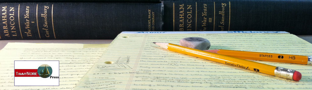
If you’re feeling really ambitious, there’s a fabulous set of volumes by Carl Sandburg (he’s the poet)—2 volumes entitled The Prairie Years, and 4 volumes entitled The War Years. Together they constitute a superlative biography of Lincoln and the American cultural and political environment in which he lived and governed. Make yourself a promise to read these volumes some time in your life.
Finally there is an ongoing series The Civil War: Told by Those Who Lived It, which will consist of four volumes published by Library of America. McElfresh Map Company prepared the endpaper maps for each volume.
McElfresh Map Company will be watching a new movie coming to town with more than a little interest.
We received a phone call at our office on the afternoon of August 26, 2011 from Terry Alford, a professor at Northern Virginia Community College. He wondered if we’d be willing to share some information about Civil War map making with some folks making a Lincoln related Civil War movie. I said certainly.
Very shortly thereafter I got a telephone call from a woman named Leslie McDonald. She was with a company called “Office Seekers.” She was interested in having someone with a Civil War map background to answer some questions. She was with a movie company. I said I’d be quite prepared for that eventuality.
We talked back and forth a bit, I answered some general questions. She said she would like to e-mail a detailed set of questions if that was all right. I said that would be fine. She also asked if I’d be willing to suggest additional questions that “they hadn’t asked but should.” That impressed me. She wanted to get things right. “So,” I said, “This is a real movie, a TV movie, or what?”
She told me it’s a movie based on Doris Kearns Goodwin’s book Team of Rivals. The director of the movie was Steven Spielberg. I said, “Ah, this is a real movie.” She laughed. “Oh yes.”
She had some general questions regarding reference material, Civil War map resources, sample Civil War era maps and the preparation and use of maps before, during and after a battle.
That evening (6.06 PM) a list of 12 questions was e-mailed to me. The questions were mostly map specific:
How would they update troop movements and how would they do this for the President?
How did they track movements on maps?
What type of writing instruments did they use to update maps, i.e. pen, pencils, colored pencils?
How would maps in the White House differ from the field maps?
Some of the initial questions also regarded the treatment and handling of battle casualties and soldiers killed in battle:
Did they write down who died right away or after the war was over?
As per Leslie McDonald’s request, the next day I e-mailed her a brief overall perspective of the who, what, when, where, why and howof Civil War mapping. How important maps were, especially to Union forces operating on unfamiliar ground in unfriendly territory. I told her where to find examples of Civil War maps and descriptions of how they were prepared and used and to what effect.
I also emphasized what an immense affair the Civil War really was and how magnificently a ramshackle government inWashingtonmanaged the whole affair. The various departments were casually organized, the army and navy operated in a very off-the-cuff manner compared to the hidebound rigidity of the modern military. The President throughout the war never travelled more than 100 miles from Washington, wrote his own speeches, and ran the nation and the war with the assistance of two secretaries.
To provide perspective, I noted that the death rate of soldiers in the Civil War, if adjusted to the present population of theU.S.would be 3,000 soldiers killed and dying every day for four years.
I also described the topographical challenges faced by road bound, foot and horse-powered armies. How a slight grade or a three foot deep creek could stop 50,000 men dead in their tracks. How the marching armies lived off the land and had to keep moving or starve.
I also assessed the capabilities of the Union and Confederate armies and pointed out that Union forces faced a far greater challenge than the Confederates because they had to march, fight, capture, hold, occupy, supply, and continually advance through the southland. The Confederates didn’t have to fight pitched battles around Detroit, or Chicago or New York. The Union had to capture and hold New Orleans, Memphis, Nashville, Savannah, Vicksburg et al.
Over the next days and weeks I answered questions:
How would maps be carried in the field?
Answer: Sherman, e.g. carried them in his saddlebags. Others in map canisters. Cavalrymen stuck the maps in their pockets.
What sort of maps did the President have in the White House?
Answer: Most likely Lincoln’s office contained U.S. Coast Survey maps (this organization is the predecessor of the modern National Oceanographic and Atmospheric Administration (NOAA) and standard commercially printed maps (Colton’s e.g.) The maps specifically, historically, known to have hung in Lincoln’s office were a U.S. Coast Survey map of KY and TN and a “statistical” slave map, showing by lighter and darker shading the slave population of the different regions of the country.
What sort of maps were in the War Department’s telegraph office?
Answer: What’s described as “a common U.S. map” on the wall (meaning a commercially printed U.S. map) and then there were map files, filing cabinet-like wide drawers in which maps could be laid flat and stored.
I also described the various instruments the mapmakers would be using: the Schmalcalder compasses, plane tables, field glasses, the watercolor paints that would come in blocks rather than tubes. I further informed the moviemakers that there was no way for Lincoln or Secy of War Stanton to interfere in the actual progress of a battle. I told them Lincoln or Stanton might urge the generals to “put all of your men in” but they’d have no way of knowing what was happening on the actual battlefield.
My last e-mails in early October with the “Office Seekers” crew was to supply names and contact information for locating the appropriate topographical instruments to “decorate” the movie set.
Note the a map displayed in Lincoln’s office in the trailer below.